Survey Plat Image - 17S 18E, Gila-Salt River Meridian, AZ
A 1911 Survey of Township 17S, Range 18E, Gila-Salt River Meridian, AZ which contains portions of the Cienega Creek Natural Preserve and the Empirita Ranch.

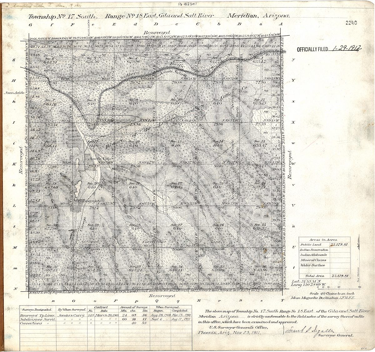
Plat Image downloaded from the BLM's General Land Office Records Site for 17S 18E, Gila-Salt River Meridian, AZ

Tags:
Created by Charles Miles on 7/4/2020. Updated on 8/2/2020.