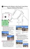
Saved 4/11/2020
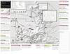
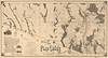
The Cline Library of Northern Arizona University hosts the Harvey Butchart Collection, the maps and trail logs of famed Grand Canyon backpacker Harvey Butchart (1907–2002) who taught in their mathematics department. They have generously made the entire collection available on their web site.
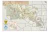
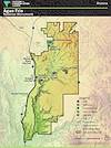
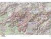
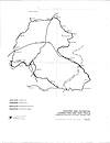
But they list his annotated Grand Canyon National Park topographic maps and USGS quadrangles alphabetically, by name, which makes them difficult to browse. So I have constructed the following index map — simply click on one of the orange boxes to open the map covering that area:
Useful way to browse the Butchart maps.