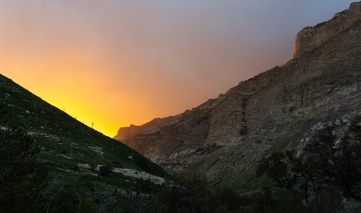
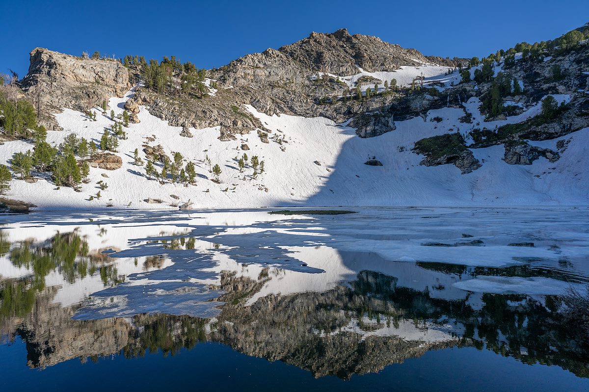
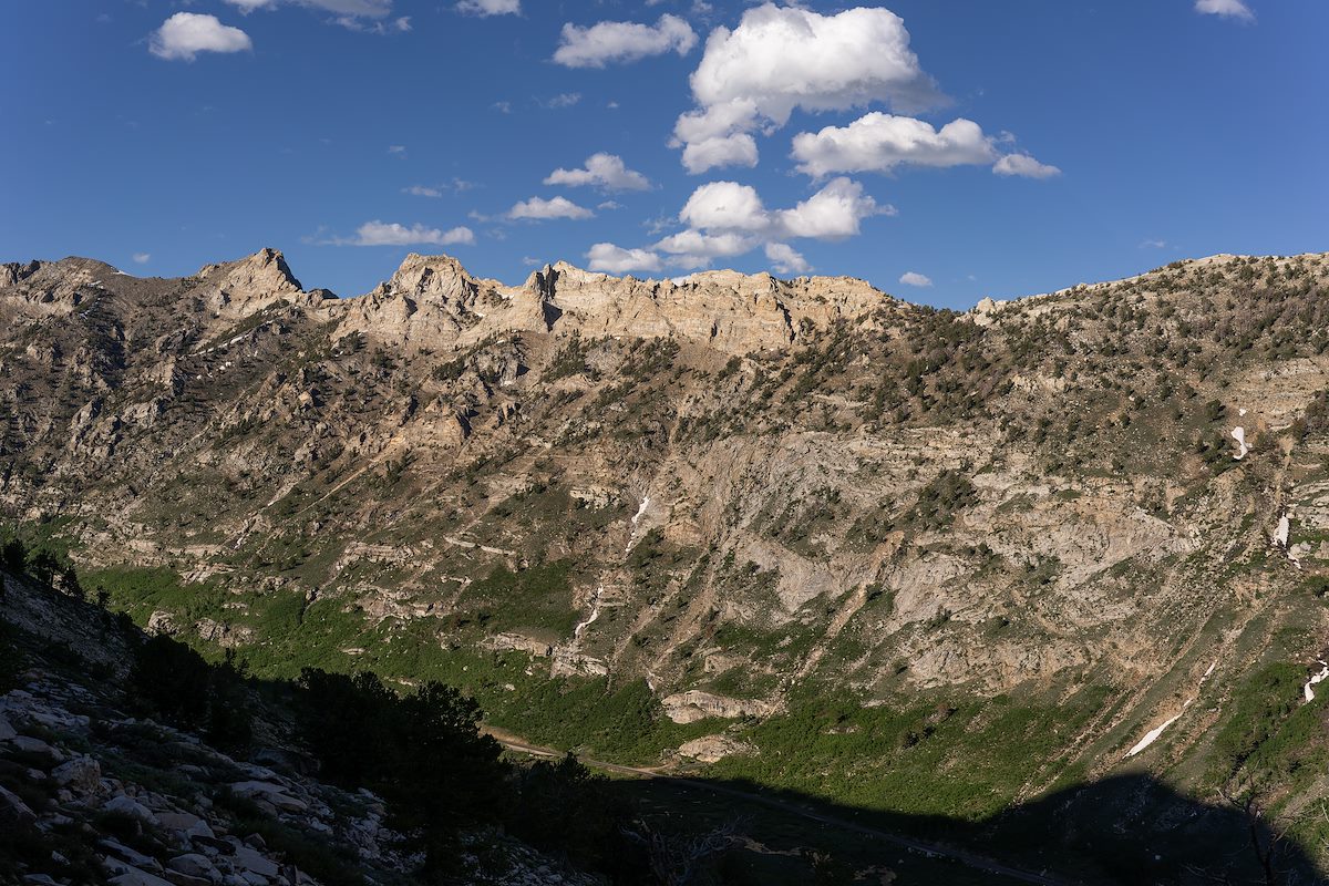
I was tired from travel and meetings - Lovelock, Winnemucca - missing home a bit - Battle Mountain - and headed east - Elko. I turned south still not sure about the decision to drive hundreds of miles for 2 nights - and then the Ruby Mountains came into view... From 227 the high, rocky, snow covered peaks are spectacular and, to me, unexpected. I didn't come prepared for the snow covering the trails and wasn't able to do all the hiking I had imagined - but immensely enjoyed seeing the range for the first time!
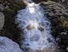
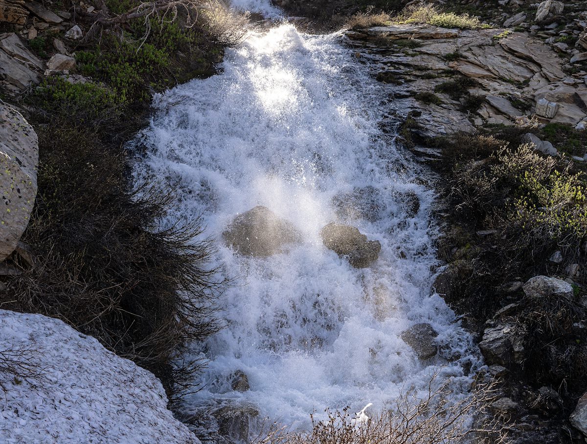
During my visit the range was dominated by the sound of water - coming from Tucson it was especially spectacular to hear and see water ... everywhere. This recording was made in Thomas Canyon - not too far from the Thomas Canyon Trail, late in the evening on a long summer day. Water dominates but the bird song is also a constant - listen closely and you can hear an occasional insect, some vehicles on 660 making their way thru Lamoille Canyon, and a hiker's poles on the trail.
The paragraphs below are excerpts from History of the Humboldt National Forest by Fred P. Frampton, Humboldt National Forest Cultural Resource Series #1, June 1992 (reformatted July 2008):
The Humboldt River and, presumably, the East Humboldt Mountains were named by John C. Fremont after his surveying expedition into the Great Basin in 1843. Fremont named the river and the mountains in honor of Baron von Humboldt, an early-day scientist who probably never saw them. Many people wonder, when they see the name East Humboldt Mountains, where the Humboldt Mountains are. An 1869 map, made by Cadwallader, of the route to the White Pine mines on the current Ely Ranger District names the Ruby Mountains the Humboldt Mountains. It may be that both designations "Ruby" and "Humboldt" were interchangeable in the early days and that "Ruby" eventually came into more common usage. The name Ruby comes from early settlers, soldiers, and travelers finding garnets on the southeast end of the range.
Overland Pass, on the south end of the Ruby Mountains Ranger District, was the route of the ill-fated Donner Party, as well as of the Pony Express and Overland Mail and Stage.
The Ruby Mountains region was the first to be impacted by trappers, explorers, emigrants, settlers, and the military in northeastern Nevada. Some of the highest density of ranches in the state of Nevada occurs surrounding the Ruby Mountains Ranger District. Residents include descendants of Mormon pioneers who were sent to settle the area by Brigham Young, as well as descendants of people who developed stagecoach way-stations and ranches beginning possibly as early as the 1850s. Still others may be descendants of those who occupied Forts Ruby and Halleck
In 1913, a hydroelectric plant was constructed near the mouth of Lamoille Canyon at the site of the Powerhouse Picnic Area. This hydroelectric plant furnished power to Lamoille and to Elko for many years but was abandoned in late 1971 after a fire destroyed the power generating plant. The flume to this plant is visible along the north canyon wall above the Lamoille Canyon road extending from the vicinity of the Lions Camp to the Powerhouse Picnic Area. The only small hydroelectric plant found in Nevada still exists on Trout Creek on the north end of the East Humboldt Range. This functioning plant, constructed in 1927, originally supplied all the power to the town of Wells and surrounding areas.
Residents of Elko and Lamoille petitioned the Humboldt National Forest in the early 1920s to construct a road into Lamoille Canyon. No progress was made to this end until the late 1930s when the Lamoille CCC camp constructed a road and campgrounds. The road was widened and paved in the early 1960s.
The Civilian Conservation Corps was active on this District building roads, fences, and campgrounds, fighting fires as well as Mormon Crickets, and constructing numerous Forest facilities. The Lamoille Guard Station, formerly the Ruby and Lamoille Ranger District Office, was constructed and landscaped by the CCC in the mid to late 1930s. The Lamoille Guard Station is one of the most picturesque on the Forest, if not in all of Nevada. They also constructed a Guard Station at the Terraces in Lamoille Canyon and another in Clover Valley. The Terraces structures were removed, probably because of avalanche danger, and the house is now at the Supervisor's Compound in Elko. The building from Clover Station was moved to Ruby Guard Station.
Because of the unexcelled beauty of the Ruby Mountains, the Ruby Mountain Scenic Area was established on January 19, 1965. The scenic area covered 40,720 acres in the heart of the Ruby Mountains from Ruby Dome and Verdi Peak on the north to the heads of Long Canyon and Mayhew Creek on the south.
On December 15, 1989, the Nevada Wilderness Bill created the East Humboldt Wilderness of 36,900 acres and the Ruby Mountain Wilderness of 90,000 acres. These two areas account for approximately 33% of the Ranger District. The unparalleled hiking in the Wilderness areas, as well as campgrounds and easy access in Lamoille Canyon, makes the Ruby Mountains Ranger District the most heavily used recreation area on the Forest.
Dear Sirs, In going through some of mom's pictures, I came across some photos of the Ski Lodge the boys had built above the turn around in Lamoille canyon. Three young men around 1956 decided to build a ski resort. They hauled all the lumber up the canyon. It had a large fire place. They bought a drug Store Fountain with a counter & stools. At the time it would have been one of the longest ski runs in the US. They had tried to get backing from the Local hotels & various other places. They had a long lease from the Forest Service. Then several years later a man who worked for the Forest Service decided he was going to do the same thing, so the boys unable to put their plans into operation had to remove the ski lodge. In looking at your brochure, I thought maybe something could be put on spot or mentioned regarding this. We were born and raised in Elko & still go to the canyon. - Beth Salls Moore