Saved 1/16/2021
Saved 5/1/2020
A brief description and map of Pima County's Coyote Mountains Sites Acquisition - 2004 General Obligation Bonds, US Fish & Wildlife Service, $1,409,786, Project Number: CSUCOYOTE, Completion Date: March 2005
Saved 1/13/2021
NEPA page for the 2018 documents that led to the 2020 acquisition of land adjacent to the NE Coyote Mountains Wilderness to provide public access.
Saved 12/25/2020
Coyote Mountains Wilderness: Information, photos and maps of the Coyote Mountains Wilderness area west of Tucson, Arizona
Saved 12/25/2020
Saved 12/25/2020
Coyote Peak : SummitPost.org : Climbing, hiking, mountaineering
Information on climbing Coyote Peak from the W Dills Best Rd access.
4/8/2020
Coyote Mountain 6,529′ Southern Arizona Total Time: 9:55 Distance: 10.1 miles Elevation Gain: 4500′ Crux: Class 3 Trailhead: End of W Dills Best Rd, no services I had made some good pro…
A View Across the Hay Hook Ranch from Point 4181 with Mount Lemmon in the distance.
Tags: arizona,bell mountain,coyote mountains,coyote mountains wilderness,hay hook ranch,martina mountain,mica mountain,mount lemmon,pima county,point 4181,rincon peak,sharp peak,sierrita mountains,silver bell peak,wasson peak
Tags: arizona,bell mountain,coyote mountains,coyote mountains wilderness,hay hook ranch,martina mountain,mica mountain,mount lemmon,pima county,point 4181,rincon peak,sharp peak,sierrita mountains,silver bell peak,wasson peak
1/5/2025
Tags: arizona,coyote mountains,coyote mountains wilderness,coyote mountains wilderness area,pima county,tucson field office
1/5/2025
Dam near the NE corner of the Coyote Mountains Wilderness.
Tags: arizona,coyote mountains,coyote mountains wilderness,coyote mountains wilderness area,dam,pima county,tucson field office
Tags: arizona,coyote mountains,coyote mountains wilderness,coyote mountains wilderness area,dam,pima county,tucson field office
1/5/2025
Gu Achi Peak.
Tags: arizona,coyote mountains,coyote mountains wilderness,coyote mountains wilderness area,gu achi peak,pima county,point 4181,tucson field office
Tags: arizona,coyote mountains,coyote mountains wilderness,coyote mountains wilderness area,gu achi peak,pima county,point 4181,tucson field office
1/5/2025
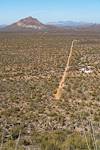
Looking down on the road and homes of the west edge of the Hay.
Tags: arizona,bell mountain,coyote mountains,coyote mountains wilderness,dills best road,hay hook ranch,pima county,silver bell mountains,silver bell peak,waterman peak
Tags: arizona,bell mountain,coyote mountains,coyote mountains wilderness,dills best road,hay hook ranch,pima county,silver bell mountains,silver bell peak,waterman peak
1/5/2025
Tags: arizona,coyote mountains,coyote mountains wilderness,coyote mountains wilderness area,pima county,tucson field office
1/5/2025
Tags: arizona,baboquivari peak,coyote mountains,coyote mountains wilderness,coyote mountains wilderness area,mendoza canyon,pima county,point 4462,tucson field office
1/5/2025
2021 January Looking over the canyon north of Mendoza and the Altar Valley to the Sierrita Mountains
Tags: arizona,bell mountain,coyote mountains,coyote mountains wilderness,coyote mountains wilderness area,keystone peak,mount hopkins,mount wrightson,pima county,point 4181,samaniego peak,san cayetano peak,sierrita mountains,tucson field office
1/5/2025
Tags: arizona,coyote mountains,coyote mountains wilderness,coyote mountains wilderness area,pima county,tucson field office
1/5/2025
Old Trail Construction in the Coyote Mountains.
Tags: arizona,coyote mountains,coyote mountains wilderness,coyote mountains wilderness area,pima county,trail,tucson field office
Tags: arizona,coyote mountains,coyote mountains wilderness,coyote mountains wilderness area,pima county,trail,tucson field office
1/5/2025
Bell Mountain, Sharp Peak and Martina Mountain. Silver Bell Peak and Waterman Peak in the distance on the left.
Tags: arizona,bell mountain,coyote mountains,coyote mountains wilderness,martina mountain,pima county,point 4181,sharp peak,silver bell peak,waterman peak
Tags: arizona,bell mountain,coyote mountains,coyote mountains wilderness,martina mountain,pima county,point 4181,sharp peak,silver bell peak,waterman peak
1/5/2025
Tags: arizona,coyote mountains,coyote mountains wilderness,coyote mountains wilderness area,pima county,tucson field office
1/5/2025
Tags: arizona,coyote mountains,coyote mountains wilderness,coyote mountains wilderness area,pima county,tucson field office
1/5/2025
Tags: arizona,coyote mountains,coyote mountains wilderness,coyote mountains wilderness area,pima county,tucson field office
1/5/2025
Tags: arizona,coyote mountains,coyote mountains wilderness,coyote mountains wilderness area,pima county,tucson field office,water jug
1/5/2025
Tags: arizona,bell mountains,coyote mountains,coyote mountains wilderness,pima county,point 4181,water jug
1/5/2025


