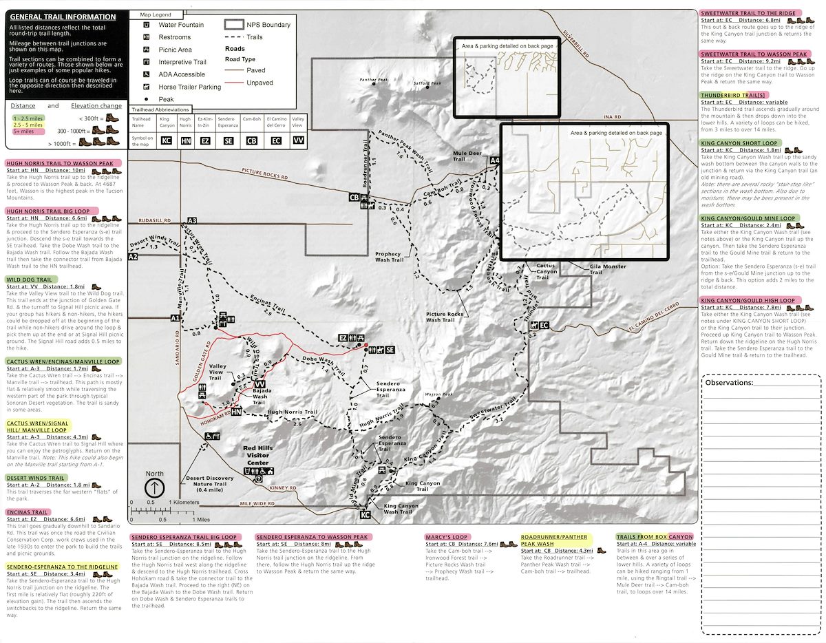
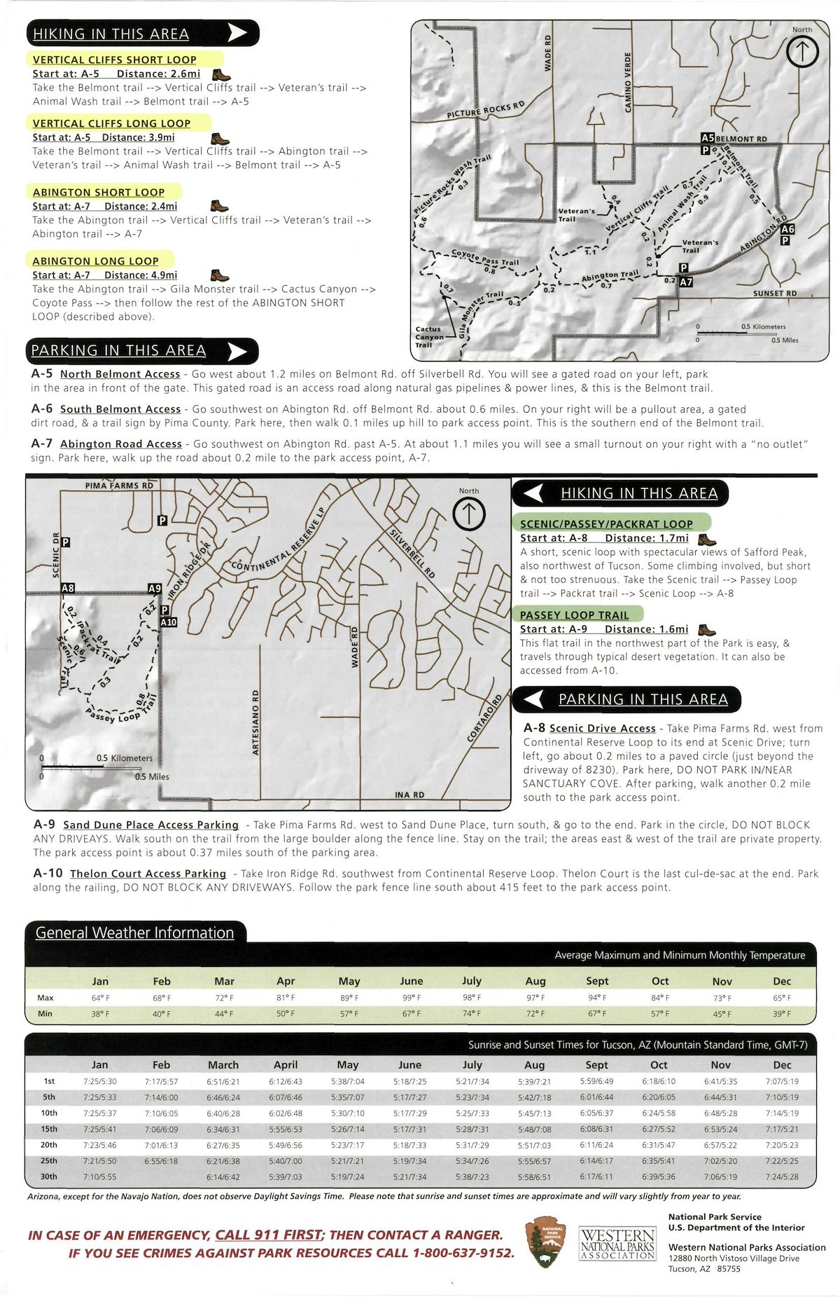
A 2019 hiking guide from the National Park Service for Saguaro National Park West. The trails of the Tucson Mountain District are shown on several maps, many of the trails receive ratings and short descriptions and the brochure includes details on many of the smaller/lesser known access points into the mountains.
While this map shows some adjacent areas it focuses on the northern section of the Tucson Mountains inside the boundaries of Saguaro National Park. For information on the southern section of the Tucson Mountains see Pima County's Tucson Mountain Park Map - September 2019.
The 3rd page of this document details the Scenic Loop and Belmont Area Trails and parking - there is a bit more information (including some pictures of the parking areas) in the Saguaro National Park Scenic Loop and Belmont Area Trails Parking Map. Some of the smaller parking areas lack dedicated parking spaces or signage and the extra information can be useful.
The 2019 Hiking Guides along with a number of other publications related to Saguaro National Park can be found on the NPS Park History Reports/Studies (Historical Documents Page) or downloaded directly from the NPS.
A similar guide is available for the Rincon District of Saguaro National Park (located east of Tucson) - Saguaro National Park - East - Rincon Mountain District - Hiking Guide - 2019.


