Coyote Mountain 6,529′ Southern Arizona Total Time: 9:55 Distance: 10.1 miles Elevation Gain: 4500′ Crux: Class 3 Trailhead: End of W Dills Best Rd, no services I had made some good pro…
Photo by Heidi Crnkovic. The King’s Anvil Ranch located in the Altar Valley outside of Tucson, Arizona is a piece of history. Unlike some relics, this ranch and the King family continue to implement the latest scientific research and technology to ensure this ranch doesn’t become a thing of the past and continues to move…
Contributed Photo/By Paul McClellan: This is the view from the top of Coyote Mountain toward Kitt Peak southwest of Tucson. Acquisition will improve hunting and recreational opportunities Contributed Article/Courtesy …
A View Across the Hay Hook Ranch from Point 4181 with Mount Lemmon in the distance. Tags: arizona,bell mountain,coyote mountains,coyote mountains wilderness,hay hook ranch,martina mountain,mica mountain,mount lemmon,pima county,point 4181,rincon peak,sharp peak,sierrita mountains,silver bell peak,wasson peak
Dam near the NE corner of the Coyote Mountains Wilderness. Tags: arizona,coyote mountains,coyote mountains wilderness,coyote mountains wilderness area,dam,pima county,tucson field office
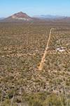
Looking down on the road and homes of the west edge of the Hay. Tags: arizona,bell mountain,coyote mountains,coyote mountains wilderness,dills best road,hay hook ranch,pima county,silver bell mountains,silver bell peak,waterman peak
Old Trail Construction in the Coyote Mountains. Tags: arizona,coyote mountains,coyote mountains wilderness,coyote mountains wilderness area,pima county,trail,tucson field office
Bell Mountain, Sharp Peak and Martina Mountain. Silver Bell Peak and Waterman Peak in the distance on the left. Tags: arizona,bell mountain,coyote mountains,coyote mountains wilderness,martina mountain,pima county,point 4181,sharp peak,silver bell peak,waterman peak
A hike into the Coyote Mountains from the northeast corner of the Wilderness. Tags: blm,coyote mountains wilderness,martina mountain,mendoza canyon,sharp peak,tohono oodham nation
In 1990 Representative Morris Udall's Arizona Desert Wilderness Act created 38 new Wilderness Areas in Arizona. Tags: aravaipa canyon wilderness,arizona,baboquivari peak wilderness,coyote mountains wilderness,morris udall,north santa teresa wilderness,redfield canyon wilderness,wilderness
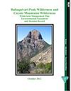
The Wilderness Management Plan, Environmental Assessment and Decision Record for the Baboquivari Peak Wilderness and Coyote Mountains Wilderness. Tags: altar valley,baboquivari peak,baboquivari peak wilderness,bobaquivari mountains,coyote mountains wilderness,management
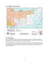
The 2018 Environmental Assessment of the BLM's plan to purchase 477 acres of land to provide better access to the Coyote Mountains Wilderness. Tags: access,baboquivari mountains,blm,coyote mountains wilderness,hayhook ranch,pima county
Located in the northwest Altar Valley the Coyote Mountains Wilderness was designated in 1990 and covers 5,080 acres. Tags: altar valley,coyote mountains wilderness,wilderness area
A section of land adjacent to the north east side of the Coyote Mountains Wilderness Area that allows legal parking and access to the wilderness. Tags: access,coyote mountains wilderness,hay hook ranch
A BLM document that was prepared to meet the requirements of the Federal Land Policy and Management Act of 1976 which required the BLM to review lands under its management for potential Wilderness Area designation. Tags: arizona,baboquivari peak wilderness,blm,coyote mountains wilderness,picacho peak wilderness study area,wilderness